The Project:
A Virtual Morrisburg Model Village depicting Morrisburg as it was before the Seaway flooding in the 1950s, together with a sign on the waterfront path showing where the old Morrisburg downtown lies under the St. Lawrence River.
 |
The HistoryThe St Lawrence Seaway was constructed in the 1950s to
accomplish two major objectives: 1) To significantly
increase the size of cargo ships able to navigate all the way
from the Atlantic Ocean to the Great Lakes; and 2) To
add substantially to the hydro electric generation capability
of the St Lawrence River for both Canada and the US. |
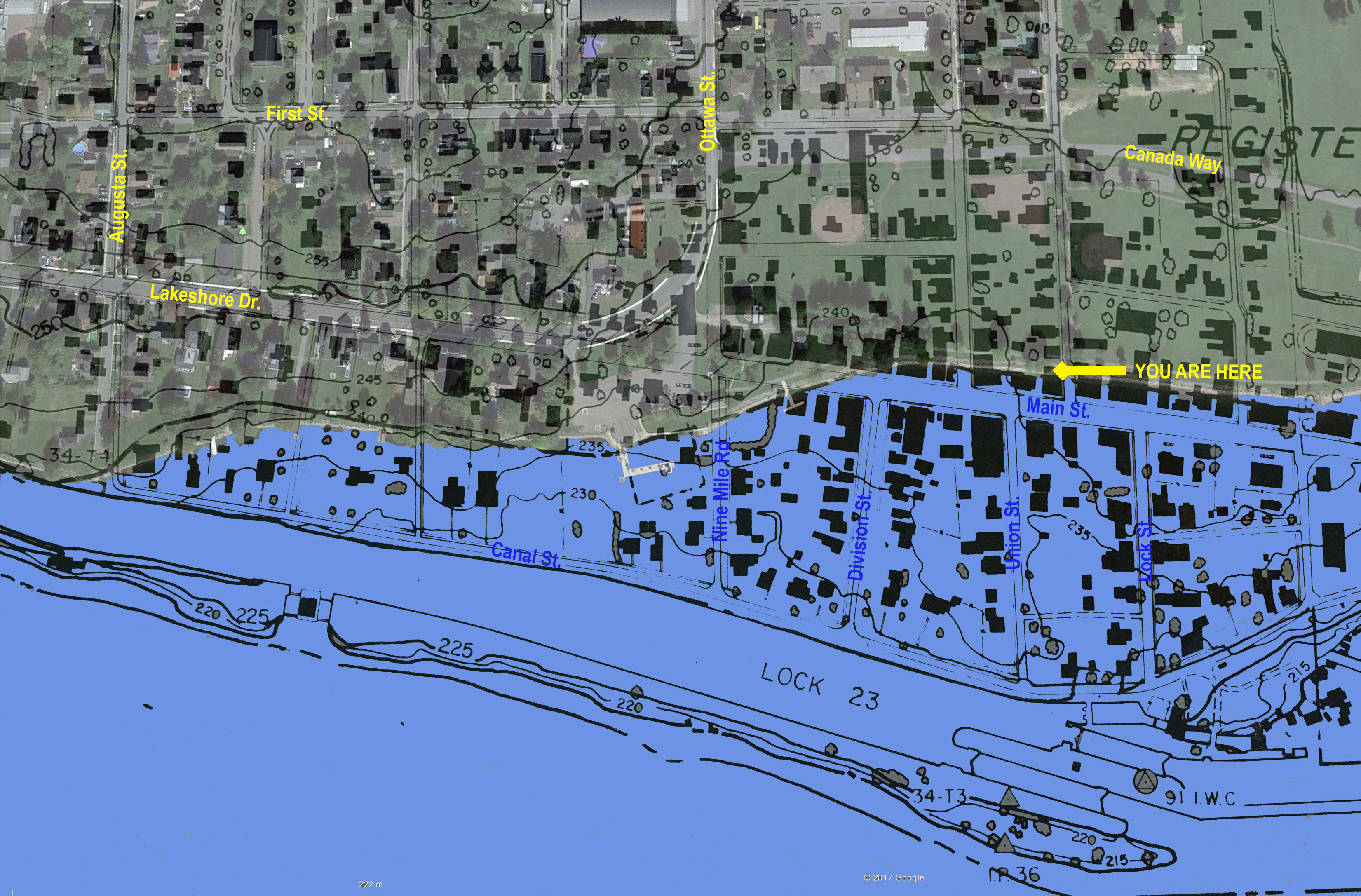 |
The Area to be RepresentedThe Morrisburg Model Village will
depict in miniature, the pre-seaway area of the village from
Augusta Street in the west to the east end of
old Lock 23 (south of the current location of
the Cruickshank Amphitheatre) and from
First Street in the north to the south end of
Lock 23 (about 300m south from Cruickshank
Amphitheatre shoreline). This is an area of about 920m E to W
by 570m N to S. |
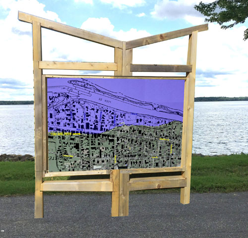 |
Waterfront SignageWe will place a
Then & Now Overlay Map sign at the waterfront. It will look
something like this: looking south toward the flooded old
downtown - with a prominent
YOU ARE HERE marker. |